Mills in Alto Aragón - harinero, powerstation
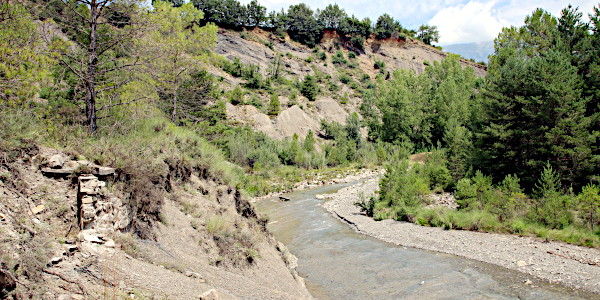
Charo / Fosado
Charo's mill is situated exactly halfway between
Fosado and
Charo along the
Río Lanata.
In former times there was a path from
Charo over
El Pocino leading down to the mill (
Camino del Pocino al molino).
Nowadays the mill is easily reached from the main road between
L'Ainsa and
Campo. Coming from
L'Ainsa and after 12 km park your car at the branch
were
Fosado is signposted. The mill is just a few steps away next to the
Río de la Nata.
The mill is private property. Do not tresspass without permission.
Pictures: 02.iii.2012, 22.viii.2017, 12.v.2024, 9.vii.2024
How water was brought to this mill is remarkable and certainly merits a closer look.
It is an ingenious system with a dam on two different rivers and a long canal through difficult terrain and crossing a mayor road two times.
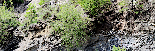
The terrain is highly susceptible to erosion, the land use has changed, and the main road has been thoroughly modified,
which means that the logic of the system is not immediately obvious.
Fortunately there is the article by
Manuel López Dueso who
described the system in 2014 (
†) and who had access to the archives (1920s & 1930s) of the owners of the mill..
He gives a description in text with some photos, but unfortunately a sketch with an overview of the whole is missing.
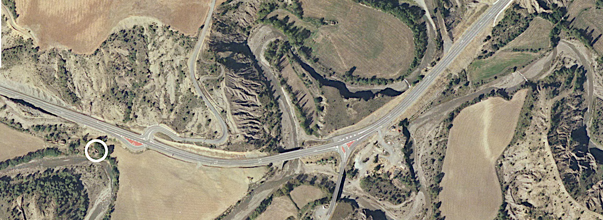
We needed more to have a clear understanding.
So, armed with his article (†), we set out to a better understanding of the system.
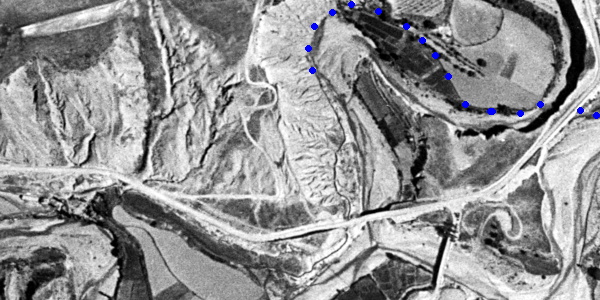
(25) The dam on the Río Nata (right white stroke in 27) — 2024
(26) The dam on the Río Nata — 2024
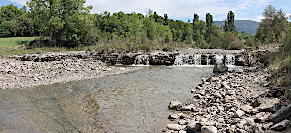
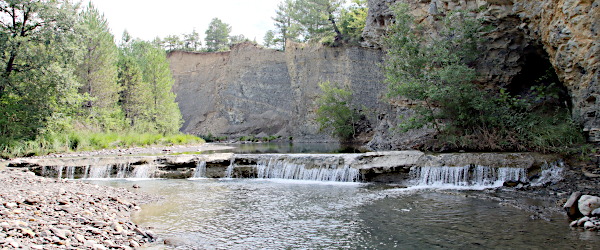
It all starts with a dam (azud) on the Río de la Nata (25– 27, 28 white stroke at right). The dam is straight and built from carefully placed layers (26) of not too large blocks of natural stone.
Despite its age, the dam is still in good condition, even though, as far as we could see, no longer in use (for irrigation, for example).
In former times, the canal departed from the right bank and ran diagonally to the southwest towards the road from L'Ainsa to Campo (the current N-240). Although there are hardly any traces left, one can still recognize its location by the row of trees on the border of the river and the field (27, 28 row of blue dots below the road).
(27) The dam on the Río Nata: camera looking towards the right bank — 2024
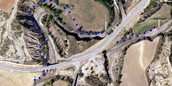
(28) Aerial view showing both dams (white strokes) and our best guess of the canal
—
bigger image which includes the position of the mill.
—
based on our field work and PNOA-2006 © IGN.es
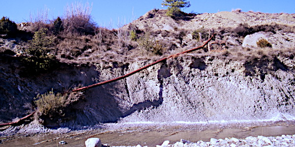
A tunnel under the road then brought the water from the Rio de la Nata to a second watercourse, Barranco (de la Nata de) Fosado, north of the road.
The tunnel ends in the cliff face of this watercourse just above another dam. The opening in the wall is still visible (right in 29, 30), but the mouth of the pipe is buried by fallen debris.
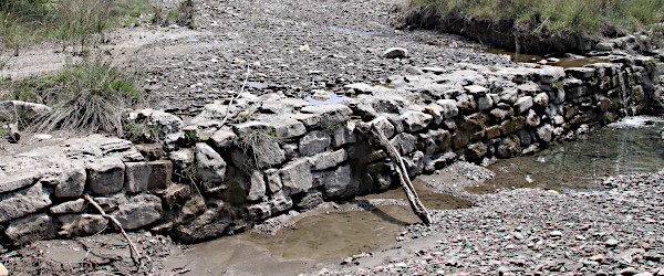
(29) The dam on the Barranco de la Nata de Fosado (left white stroke in 28) — 2024
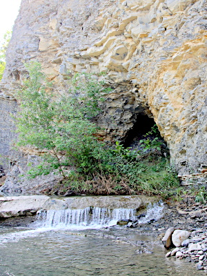
(30) Mouth of the tube above the 2nd dam — 2024
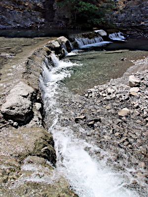
(31) This dam is curved — 2024
The canal first ran a short stretch parallel to the river (28, 32) and then turned right (to the North)
and away from to river. It made a wide arc and formed the edge of a zone of small fields (visible in 32).
The zone has now been transformed into one large field, but the former situation is still recognizable (28) and vegetables were grown on the site of the old fields at the time of our visit. We couldn't find any remains of the canal though.
After te meander, in the last straight stretch of the barranco before it reaches the río Nata,
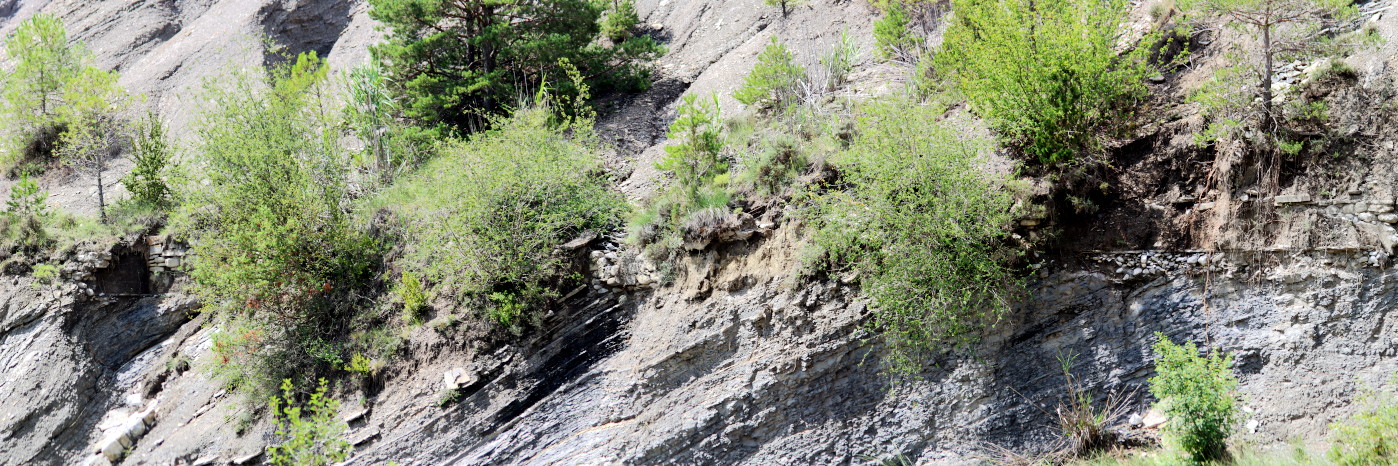
the canal (fine dark line in 32) runs along the slope in terrain that is highly susceptible to erosion (33-36).
The slope is so unstable that the canal had to be reinforced in various ways: a base layer of small stones, a base plate, walls constructed from cut stones of different sizes and reinforced with cement and in some places with concrete.
(32) Aerial view showing the former canal — Vuelo del Americano B, 1957 © IGN.es
(33) Overview of the river bend seen from approximately the end of the dotted line in 32 —
notice the remains of the canal at the left side — 2024
(34) Remains of the canal in the erosion zone
—
bigger image — 2024
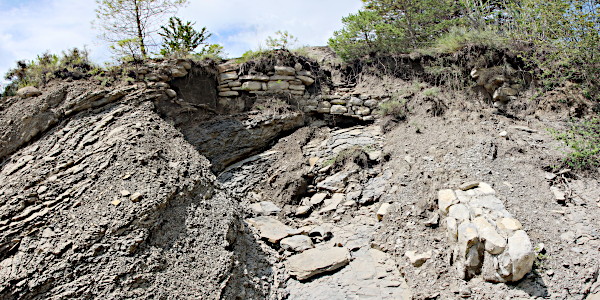
(35) Canal (top) with a slipped piece of masonry. — 2024
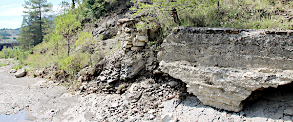
(36) Section of the canal built from concrete fallen down into the riverbed — 2024
(37) Remains of the irrigation system of the fields on the left bank of the río de la Nata — 2012
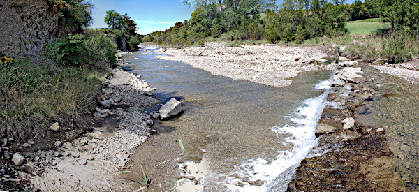
At the confluence of the barranco with the rio, the canal ducks under the road and then turns west,
towards the mill (32). Nowadays, the small fields visible here in the 1957 aerial photo have merged into one large (28) and the canal is no longer recognizable.
What does remain is a piece of the old irrigation system (37).
In the bend of the canal (approx. at the level of the leftmost dot in 28) there is a branch of the canal: from here a tube carried the water over the río de la Nata
to irrigate the fields on its left bank.
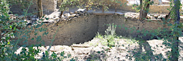
(38) The mill pond of the grain mill — 2017
The mill pond, embalse (38), has earthen walls. The stone walls
that funnel towards the pressure pipe, saetín, are set with care. They are four to five meters tall.
Notice that the eastern wall (left in 38) is curved. The other side is straight.
We have seen the same situation at the mill pond of
Samper which is only a few kms away.
† Manuel López Dueso
— 2014 — El molino de Charo. —
Revista del Centro de Estudios de Sobrarbe (ISSN: 1136-4173) N° 14; pp 101-154.

