Mills in Alto Aragón — harinero, central eléctrica
Aguinalíu
Aguinalíu is easily reached from the
main road between Graus and Benabarre. After about 5 km you'll find a branch to Aguinalíu — just
before Torres de Obispo (
Molino). This is a narrow road running to the south.
After about 3 km you'll dive under the main road coming from Barbastro. It's now less than
3 km to the mill which is located about where the village comes in sight (look out for the configuration of pict 1).
The mill is built next to the Barranco del Salinar.
Pictures: 15.xi.2008
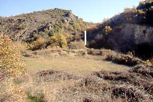
The mill is almost invisible from the road but its position is betrayed
by the really huge embalse (1). I couldn't find a trace of a feeding duct. That is probably because
the supply channel is carried away by the rivulet which makes a sharp turn around the mill. The wall
right at the foreground in picture 2 actually tops a deep erosion cliff and may be gone after the next thunderstorm.
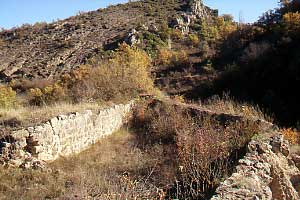
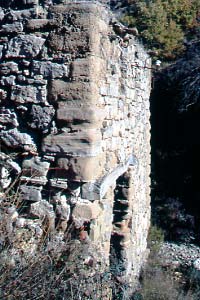
Most of the embalse is confined between earthen dams but the stretch
closest to the mill narrows down to the cubo between carefully crafted walls (2).
The cubo (3) is topped with a closing stone. The top half of the cubo opens to the reservoir: this is
called a
contrabalsa (4). So we have a large body of water and a good pressure building device.
We've seen similar devices in e.g.
Ribera de Vall and
Huesca.
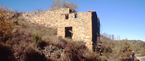
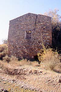
The first picture clearly illustrates the height difference between
the water level in the reservoir and the position of the wheel in the cárcavo (same level as the person).
That is quite a drop.
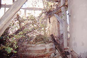
The mill had two floors but there is nothing left of the top floor but some rubbish
on the ground. The wall facing the river (6) suffers from a wide fissure and is proof of the poor
state of the construction in general. Some of the building blocks must be from very soft material: they
are severely eroded.
Some insulators on the façade (5) tell us about
earlier times when the mill generated electricity. The map of the Spanish Instituto Geográfico Nacional in its 1932 edition
features a powerline running from the mill to the village of Aguinalíu. No further extensions were shown. The line
is still there in the edition of 1952.
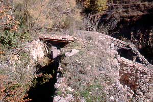
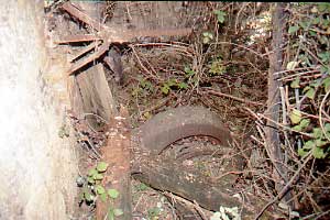
The inside was a trifle difficult to explore because of the thornbush, but nothing withstands
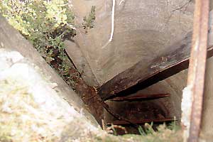
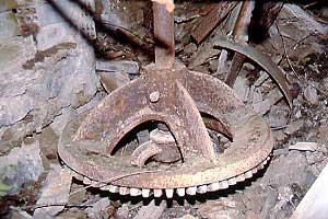
a determined mill adept. At the far side (located above the cárcavo) a turbine (9, 12) was found. The only turbine
moved a generator and a milling unit probably by means of a ribbon (see the beltwheel behind the cogwheel in 10).
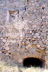
The stone couple is situated closer to the door and next to
the window in picture 6. Notice that the window frame was redone (7) and that the arch is now blind.
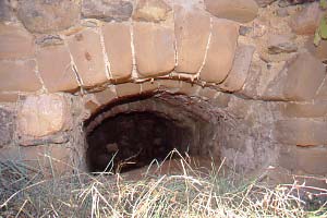
And speaking of arches: the mouth of the cárcavo is a nice piece of work with three arches in row (11).
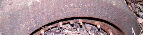
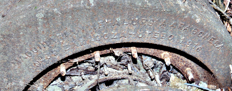
The turbine was made by
Maquinaria y Metalurgia Aragonesa, a company born in 1902 (12). Read more about its history at our page about
Salinas de Jaca where
another turbine of this brand was found.
No traces of a generator, switchboard or other related stuff were found.

