Mills in Alto Aragón - harinero, central eléctrica
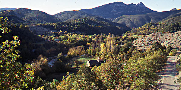
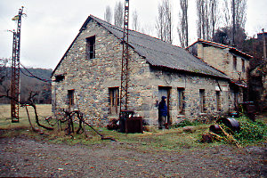
Puyarruego

Puyarruego is on the road toward the famous Garganta del Añisclo (Vallée de la Niscle for the French). Leave L'Ainsa towards Bielsa and the French border. Turn left in Escalona and follow the road until you reach the branch leading into the village. Park your car at the dedicated spot just before the bridge. It could be a bit crowded because this is one of the most popular beaches in the Sobrarbe region. 
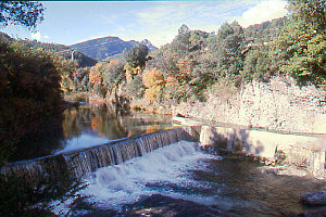
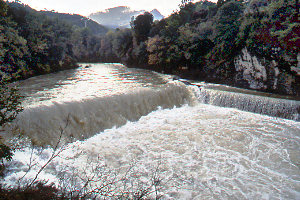
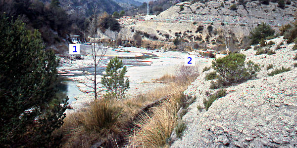
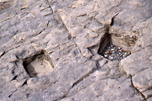
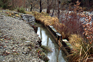
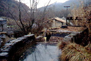
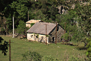
The mill is in the river bed of the Río Vellos.
The mill is ideally situated to house a visitor center for the Ordesa National Park.

Pictures: 1998 - 2011

(1) Molino of Puyarruego - 2004

(2) Dam on the River Bellos - XI.2004
(3) Dam on the River Bellos - XI.2005

Let's start with the canal. Walk to the bridge over the Río Vellos and from there walk on the left bank and against the current until you recognize the spot of pict. 4 which gives a nice overview of the tracé of the water supply channel. The dam or presa (4.1) is situated a few hunderd meters upstream.

The canal runs on the left bank of the river. The point where it connects with the dam is marked with 1983 (2, 3). The canal is in a rather good shape: wide and deep with escape doors (6) at regular intervals.

Early in its course the canal must take a serious hurdle: the confluence of the Río Vellos with a tributary, the Río Airés. A siphon was constructed (4.2) through which the canal connects with the other side.

At several places in the riverbed clearly man-made holes (5) can be found. They give the position of previous constructions to hold the water. We've noticed similar holes in e.g. Caballera, Lecina and Javierre de Olsón (poles still in place).

(4) Río Vellos with dam, siphon and canal - 2000

(5) Holes in the riverbed - 2000
Walk back to the bridge and follow the canal further to the East (6) towards the mill. You'll soon reach the end of the canal which now towers high above the river and is about level with the roof of the mill (7). There are two doors and a grid to stop material that could clog the tubes feeding the tur­bines. At the base of the head of the canal a wash­ing place was provided.

Notice that there is no lake (embalse) near the mill. There is no need for more storage because the river is never dry.

(6) Canal between bridge and mill - 1998
(7) Mill with end of the canal - 1998

(8) Front of the mills - 1998
(9) Backside of the mill - 2005

The mill originally dates from the 16th century and from 1920 on produced also electricity. The part with the corrugated roof is the former powerstation. I'm not sure about the section with the round tiles which are usually only found more to the South (e.g. Naval, Sarsa). Was it a separate grain mill, or was it the miller's house? Difficult to say because no trace of the former use can be found between the rubble.
The central eléctrica is surrounded by wiring and old gear (11). Notice also the rusty pylons (8, 9). The old line running up the hill and into the village can still be found.

Outside the other section two broken milling stones were recycled as seats. On one of them (10) the traditional spiral ridge pattern is still clearly visible.

(10) Milling stone - 1998
(11) Old gear outside the central - 1998

Previous stopelectricity trailNext stop
or learn more about Puyarruego.
Path: Home / Alto Aragón: old mills / Puyarruego
Introduction
Learn about the parts of a mill
Visit the mills; catalogue
Literature and other websites
© and e-mail: