Mills in Altoaragón - harinero
Larrés: molino Entrapar
Larrés lies in the valley of the
Río Aurín which discharges in the Río Gallego near Sabiñanigo. The mill (named molino de Larrés on some recent maps), however, is much nearer to Cartirana and Sabiñanigo than to Larrés. From Sabiñanigo take the N-260 towards Biescas and France. There is a roundabout
just before the bridge over the Río Aurín. Turn left. This is a stretch of the old road leading to Jaca. After about 0.5 km the road will rise and turn left. At that point turn right in a smaller road.
Drop your vehicle after about 100m and walk towards the river. The mill is hidden between the trees.
Pictures: 02.I.2012
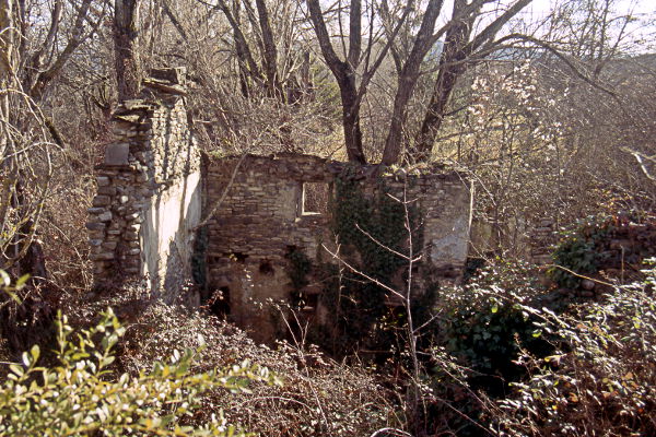
The remains of the mill were almost invisible between the trees
and the shrubs (many thorny). Only some of the outer walls were still upright (1) and,
because of the brambles, we really could not work our way into the construction and search
for traces of the former activities.
We can deduce from holes in the wall that the building
counted two floors. Probably, like in many places, the miller's living quarters would have been on the top floor and the business downstairs.
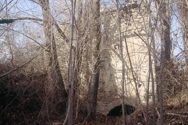
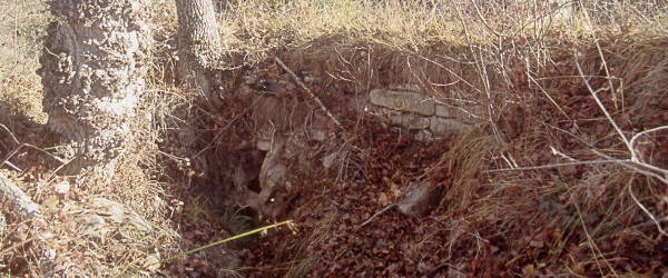
At the foot of the wall facing East (2) two outlets can be
seen. Both cárcavos are full of silt but it looks like sometimes water still
passes through the cárcavo closest to the river (3 right).
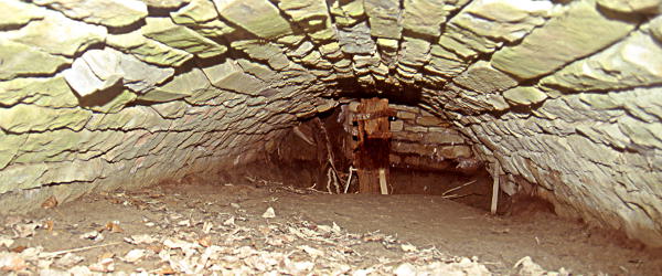
An axle-tree (arbol) made of wood and still looking rather good can be seen in the cárcavo at right (4). I am not sure if there is one in the cárcavo left also: I couldn't
come close enough because there is more silt there.
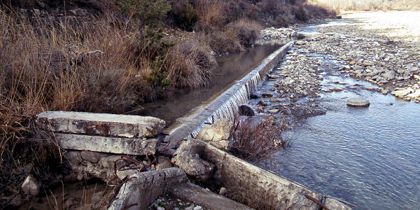
Water for the mill was tapped from the Río Aurín. The inlet of the canal (5) lies about 1 km upstream from the position of the
mill. The first stretch runs in the riverbed and is separated from the main artery of the river by a raised
bank of sand and stones.
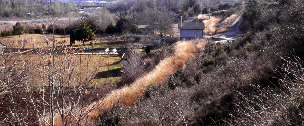
The canal then becomes a broad and deep ditch
which follows the river bank and is conspicuous in the landscape
because of the brownish colour (6) of the sedges flourishing in it. This part of the canal is
probably still used to water the lawns, gardens and flower beds (6). The final stretch
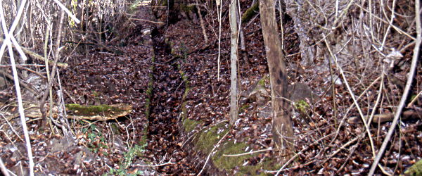
ending in the pond is more like a gutter (7).